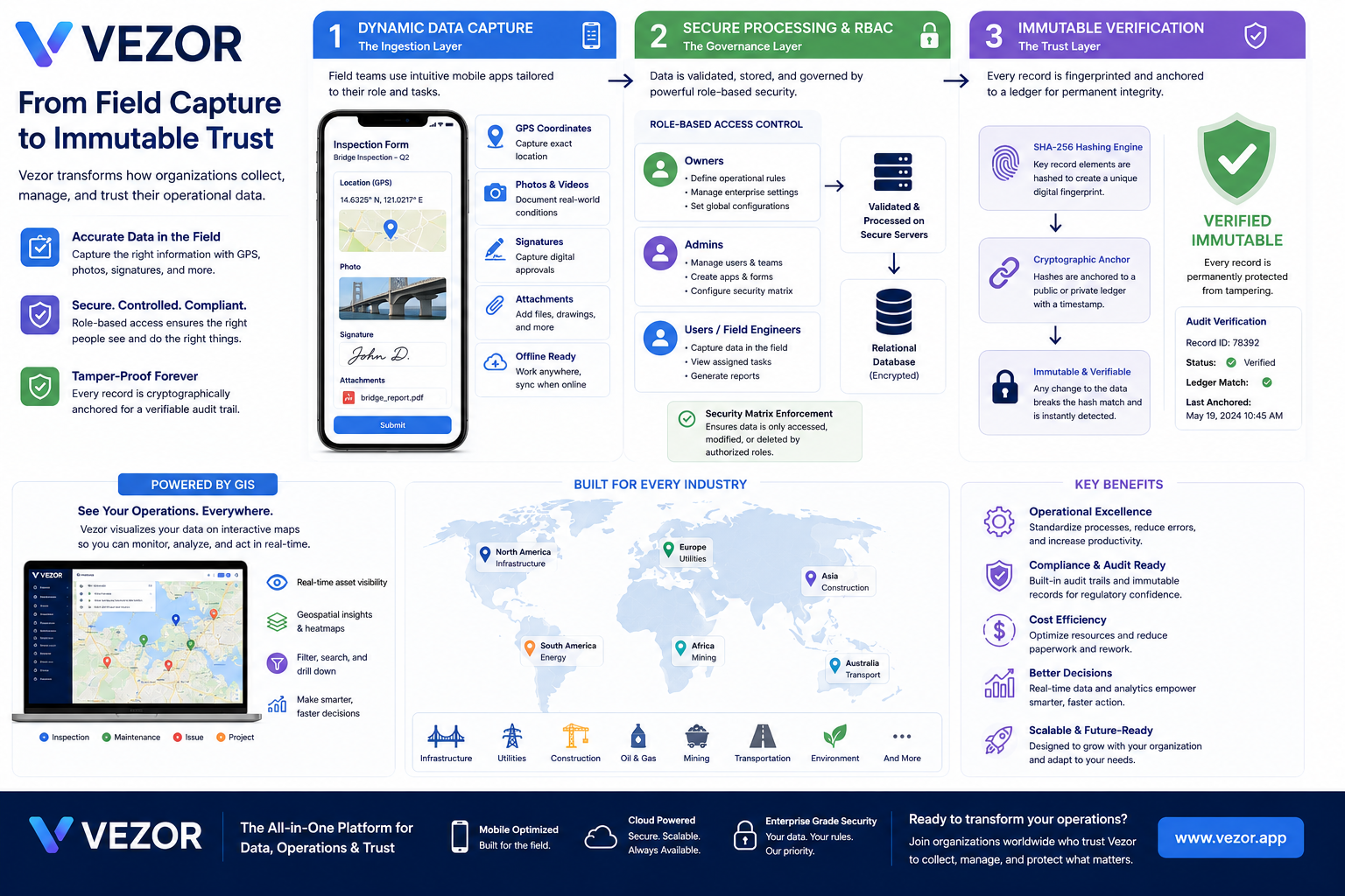
Vezor connects field operations, GIS, trusted evidence, live events, and GeoAnchor digital twins into one governed operational platform for smart cities, infrastructure, utilities, construction, and distributed operations.
It is designed to help operators observe, detect, verify, decide, and act using location-aware intelligence, trusted records, and governed workflows.
Vezor follows a governed operational pipeline: observe real-world conditions, collect trusted evidence, verify context, make decisions, and execute accountable action.
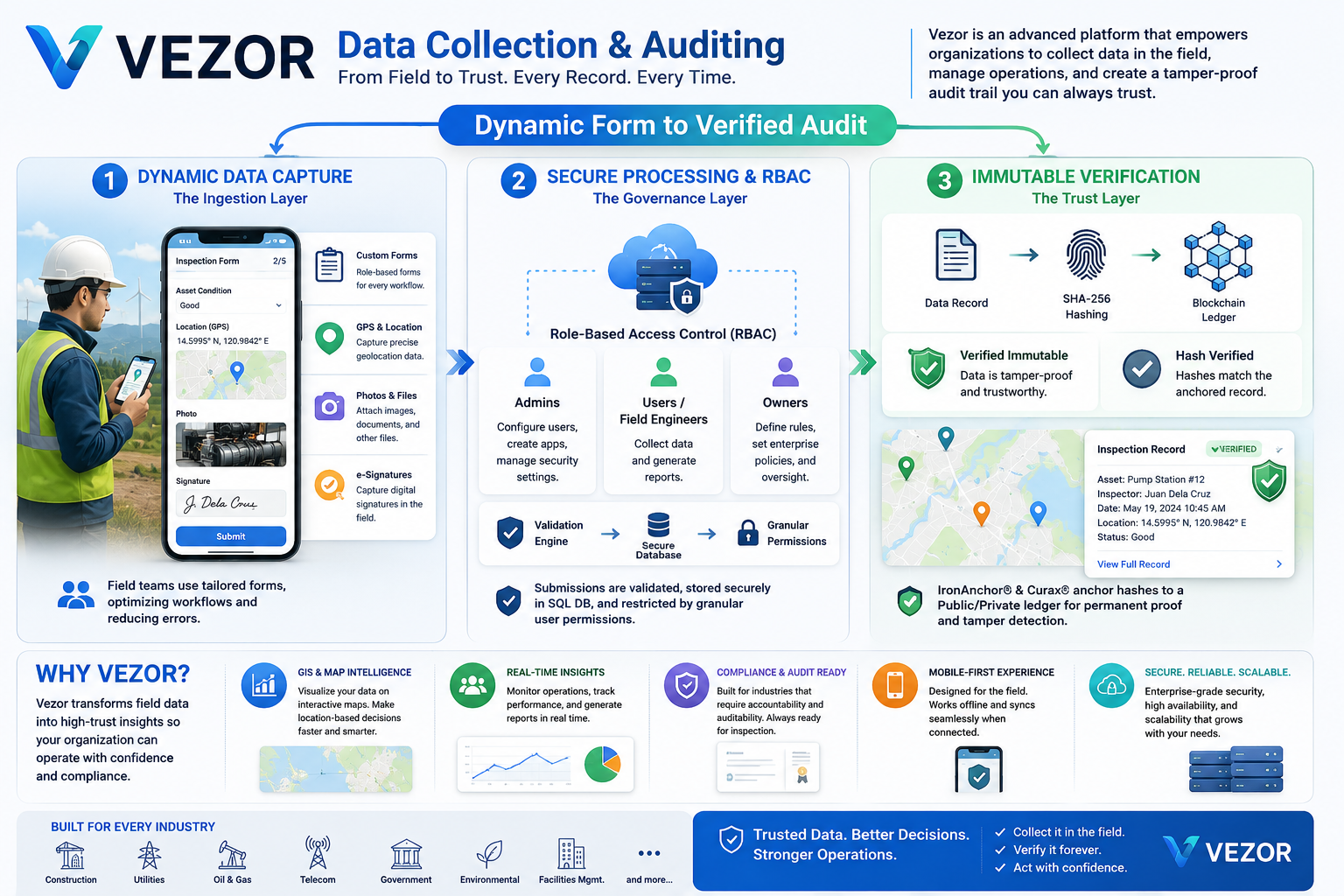
Field teams and connected systems capture location, forms, GPS, photos, video, signatures, attachments, inspections, and operational observations from the real world.
Rules, alerts, AI-assisted detection, and role-based governance help surface what needs attention while ensuring each user has the right operational authority.
Evidence, provenance, GeoAnchor context, approvals, and audit trails help teams verify what happened before decisions, incidents, and operational actions are executed.
Vezor brings assets, inspections, incidents, evidence, alerts, and operational history into interactive maps so teams can understand what is happening, where it is happening, and what action should follow.
Vezor is being extended beyond field reporting into a real-time operational layer that can connect IoT observations, AI-assisted anomaly detection, alerts, incidents, GIS context, supervisor verification, and accountable workflows.
Field/sensor evidence requires operational review.
Location-aware event elevated for monitoring.
Potential maintenance incident awaiting verification.
Environmental observation remains within normal operating range.
GeoAnchor links a real-world location or asset to its operational history: field observations, imagery, evidence, alerts, events, reviews, and verified records. It creates a trusted digital context that can evolve with the asset over time.
Vezor is designed for operational intelligence, trusted evidence, compliance, accountable action, and scalable smart-city transformation.
Standardize processes, reduce errors, improve reporting, and increase productivity across field teams.
Built-in audit trails and verifiable records support accountability and regulatory confidence.
Optimize resources, reduce paperwork, cut rework, and move field operations into a digital workflow.
Real-time data, dashboards, maps, and reports help teams act faster and smarter.
Designed for field teams today and an expanding connected-operations model spanning IoT, live events, and trusted operational context.
GeoAnchor, GIS, trusted records, and a connector-ready architecture create a foundation that can grow into broader city and enterprise digital twins.
Talk to Paniola Solutions about Vezor for smart cities, infrastructure, utilities, construction, transport, field operations, trusted evidence, and GeoAnchor digital twins.